
Baltimore Area Braces for Severe Storms After Midweek Heat Eases
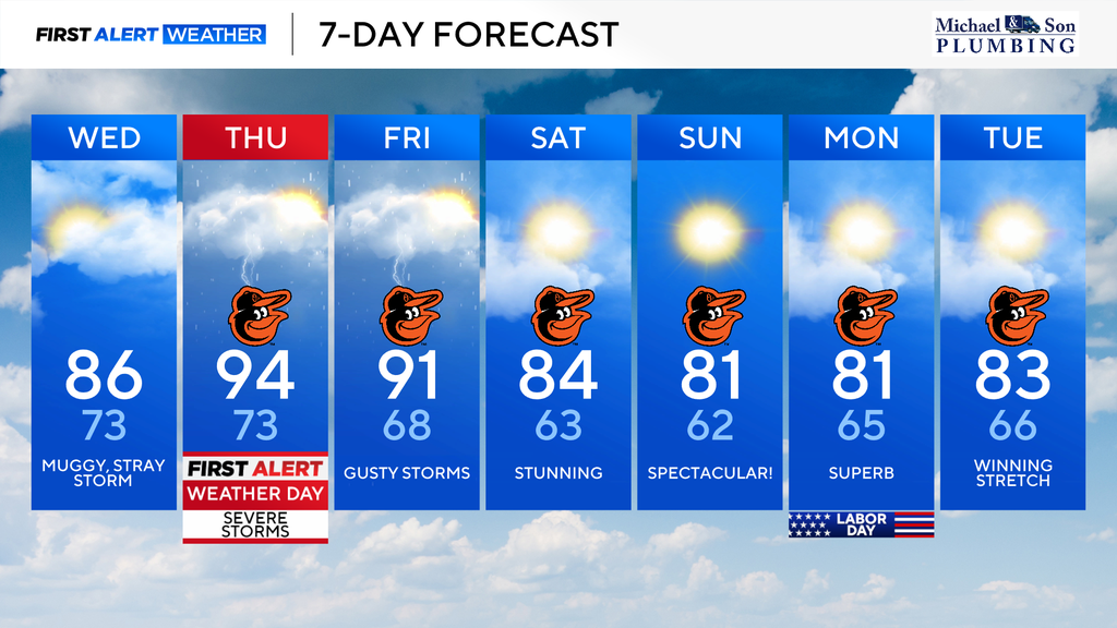
Baltimore and surrounding areas will experience easing heat on Wednesday, but a significant risk of severe storms is anticipated for Wednesday evening through Thursday. Thursday has been designated a First Alert Weather Day due to potential for intense heat, humidity,…
 Baltimore, MD, September 2, 2026 —
Residents in Baltimore and its surrounding regions can expect a temporary reprieve from the heat on Wednesday. However, this cooling trend is set to be short-lived as a significant risk of severe thunderstorms is forecast to develop from Wednesday evening and persist through Thursday.
Authorities have designated Thursday as a First Alert Weather Day for the area. This designation highlights the potential for hazardous weather conditions, including intense heat and humidity, alongside the severe thunderstorms.
The shift in weather patterns suggests a period of unstable atmospheric conditions. While Wednesday morning may bring cooler temperatures as a weather system passes, the atmosphere is expected to destabilize rapidly, leading to the risk of severe weather later in the day and into Thursday. Details regarding the specific timing and intensity of these storms, such as wind speeds, hail size, or potential for flash flooding, were not provided in the initial trend summary.
Residents are advised to stay informed about weather updates throughout the period. The combination of heat, humidity, and the threat of severe thunderstorms poses a significant weather event for the region. Further information regarding specific impacts will likely be released as the forecast evolves.
Story summarized from the original created by Steven Sosna on www.cbsnews.com, see more information here.
Media gallery

